 Map of East Crete by R. Boquist, courtesy of J. G. Younger
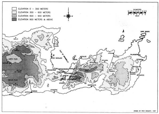
The western Siteia Mountains are located between the Mirabello and Siteia Bays in East Crete. These mountains are broken up to the west by the Ierapetra Plain that stretches from Ierapetra in the south to Pacheia Ammos and Tholos Bay in the north at the most narrow portion of the island. In the east, they are demarcated by a fertile river valley that stretches south between Siteia and Petras, flanking the route of the Pentelis, or Stomion, River as far as the ancient town of Praisos. This far eastern region is punctuated by low peaks that do not rise above 800 m in height. Two rocky massifs lie between: at the south, Thripti rises in a southwest-tonortheast ridge with its summit at Afendis Stavromenos (1,476 m); to the north, Orno rises in a west-to-east ridge with its summit at Askordalia (1,238 m). North of the Orno range lie the western Siteia foothills that are the focus of the present study.
Ancient tombs have found between the modern villages (and toponyms) of Chamezi (Kimouriotes), Exo Mouliana (Sellia), Mesa Mouliana (Sellades), Myrsini (Aspropilia), Tourloti (Plakalona), and Lastros (Langades), which were together labeled as metochia (hamlets) in the 1834 Egyptian census. Over the decades, archaeological authorities have sporadically conducted rescue excavations when deemed necessary, but no definitive, comprehensive study targeting these foothills has taken place.
Mouliana Sellades at Google Maps
